When Planes Need an Eye Test
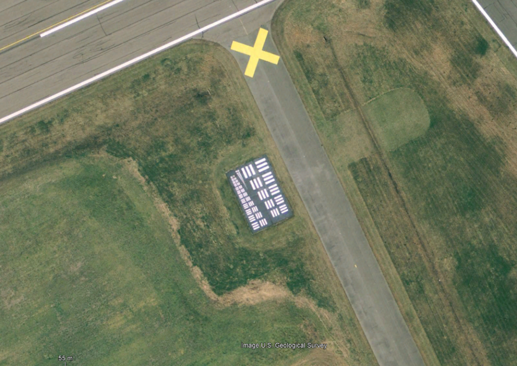
A few years ago, The Center for Land Use Interpretation (CLUI) reported on the dozens of Photo calibration targets found in the USA. They are odd looking two dimensional targets with lots of lines on the of various sizes, used as part of the development of aerial photography. Mostly built in the 1950’s and 60’s as part of the US effort of the cold war. A few still live on, with their locations being perfectly placed, unlikely to ever be built upon.
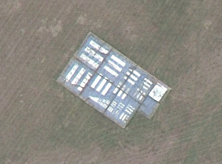
Just after the second world war, there was a huge push to get new information about the new enemy. With the battlefield changing, with the move into the cold war, the intelligence they were looking for was also different. The military needed better aerial reconnaissance. Of course this was not a new activity, even as 1794 during the French Revolutionary Wars they used tethered balloons to spy on the enemy. Over the years these methods developed, and so did the countermeasures. This very problem lead to the development of the U-2 and the SR-71. Secret spy planes that evaded known radar methods. As it was a key factor in the designs, there needed to be methods of testing these planes with the big camera systems attached to them. Prior to the advent of digital photography, these analog cameras needed specialized optics, and a lot of custom engineering to work efficiently and reliably during flight. One of the big factors was the distance required to take photos over, as planes like the U2 can fly up to 70,000 feet. Over these distances and conditions, factors like focusing, and resolution play a big part.
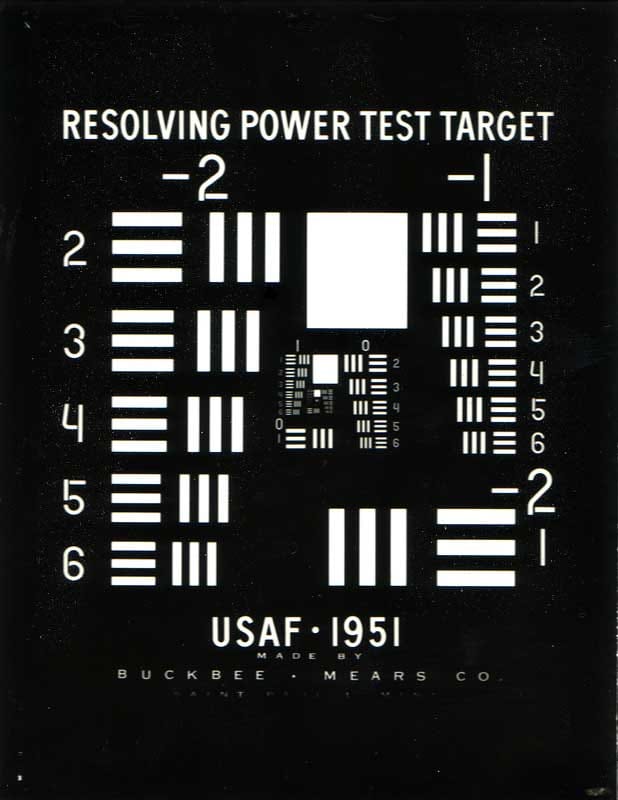

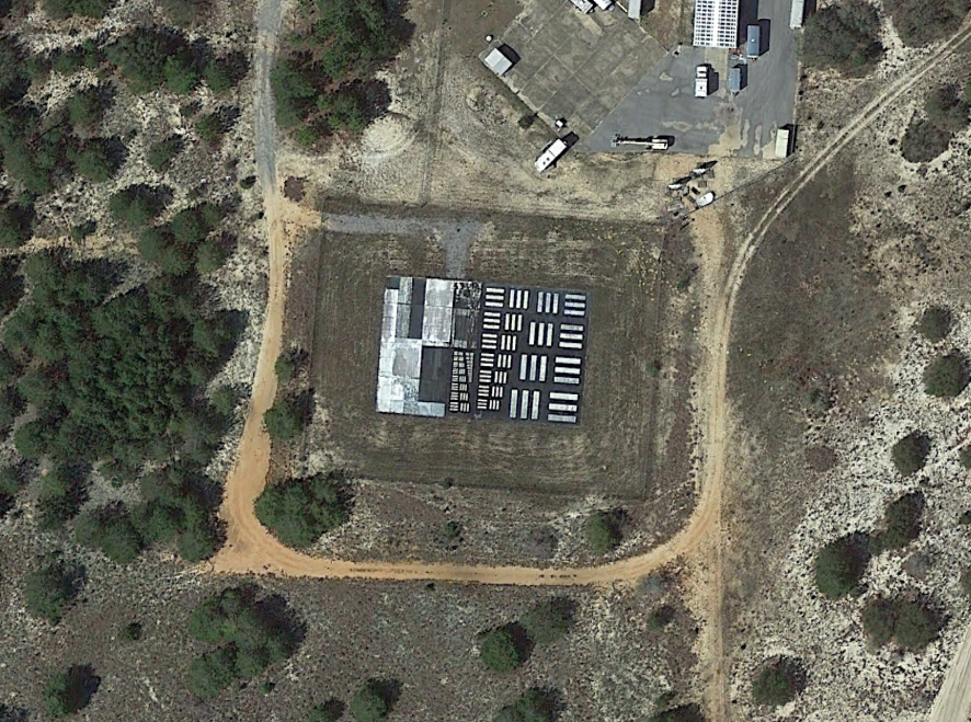
This is where the photo resolution markers came in. Much like an optometrist uses an eye chart, military aerial cameras used these giant markers. Defined in milspec MIL-STD-150A, the standardised ones are generally 78ft x 53ft concrete or asphalt rectangles, with heavy black and white paint. The bars on it are sometimes called a tri-bar array, but they can come in all forms, such as white circles, squares, and checkered patterns. Obviously not all were the same, some had very different shapes, but all followed a similar method of white bars on a black background.
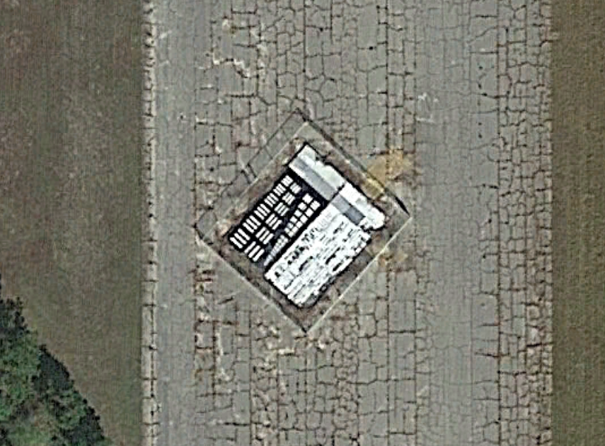
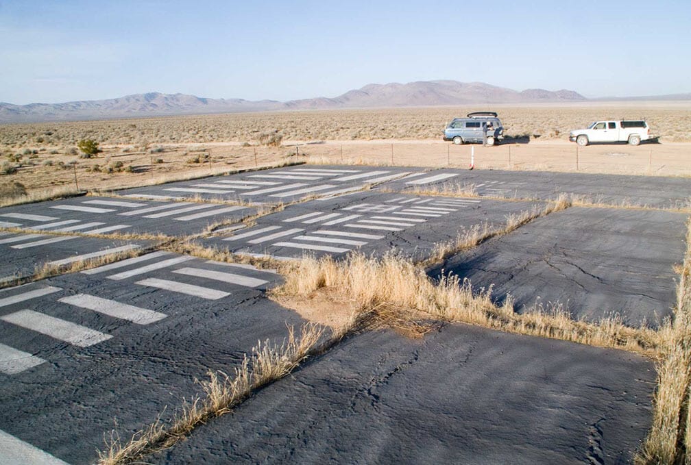
The largest concentration of resolution targets is in the Mojave desert, around Edwards Air Force Base. This is the place most new planes were tested at the time, with the X-1, U-2, SR-71 and X-15 being just some of the planes tested there. There are a set of 15 targets over 20 miles, known as photo resolution road. There are also plenty of other resolution targets at aerial reconnaissance bases across the US, such as Travis AFB, Beaufort Marine Corps Base and Shaw Air Force Base.

Who am I?
Im Ryan, an engineer with an interest in wildlife, electronics and many other things. Get in touch if you want to discuss. Follow for more content if you enjoy it. For now, I saw this cool moth recently (it might be a butterfly).